Using satellite and street view technologies helps you vet routes more safely by giving you current, detailed visuals of terrain, infrastructure, and potential hazards. You can spot risky roads, obstacles, or changes that might not be visible on maps alone. This real-time insight allows you to assess safety, plan more reliable routes, and react quickly to unexpected issues. If you want to discover how these tools can enhance your safety checks, keep exploring further.
Key Takeaways
- Utilize satellite and street view imagery to identify hazardous road conditions and infrastructure issues before route planning.
- Conduct thorough geographical analysis to assess environmental factors like lighting, traffic, and obstacles impacting safety.
- Verify current route conditions in real-time to detect unexpected hazards such as fallen trees, flooding, or construction zones.
- Enhance risk assessment by visualizing terrain, infrastructure, and environmental features relevant to safe route selection.
- Support dynamic decision-making and communication with ground teams through accurate, up-to-date visual confirmations.

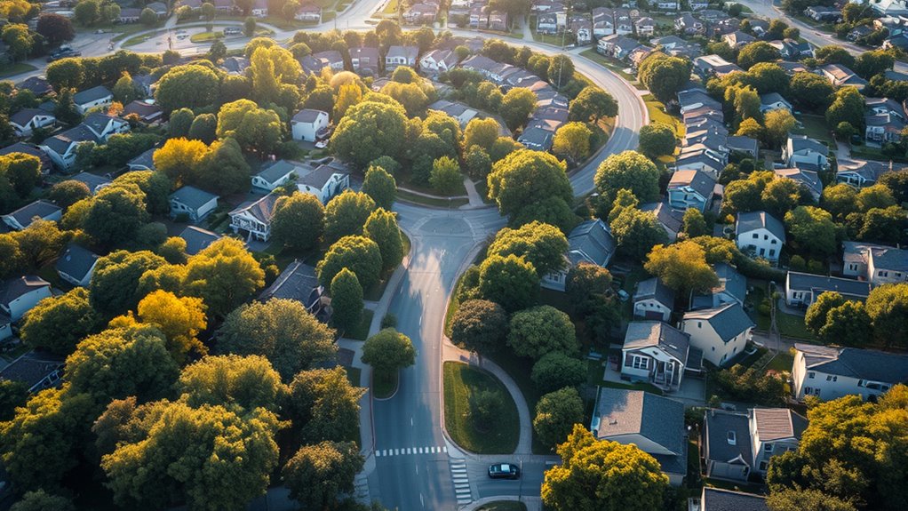
Ensuring safety in any organization begins with a meticulous vetting process, which serves as the foundation for reliable decision-making. When you’re evaluating routes for logistics, personnel movement, or field operations, leveraging satellite and street view technologies can considerably enhance your risk assessment and geographical analysis. These tools give you an all-encompassing view of the terrain, infrastructure, and potential hazards, allowing you to identify risks before they become issues. Instead of relying solely on traditional maps or reports, satellite imagery provides real-time or recent visuals of an area, revealing changes in road conditions, construction zones, or new obstacles that might impact safety. Street view, on the other hand, offers ground-level perspectives, helping you assess the usability of routes, check for signage, and evaluate environmental conditions such as lighting or crowd density. Incorporating these visual tools also supports geographical analysis by providing context that may not be apparent from data alone.
By integrating these visual tools into your vetting process, you can perform a more detailed geographical analysis, pinpointing areas that may pose safety concerns. For example, satellite images can reveal narrow or poorly maintained roads that are prone to accidents or blockages during bad weather. Street view allows you to see the actual condition of sidewalks, crossings, or entry points, ensuring they’re safe for personnel or deliveries. When conducting a risk assessment, these insights help you anticipate potential dangers, such as hazardous intersections, areas with high crime rates, or locations with unstable infrastructure. This extensive approach minimizes surprises and enables you to plan safer, more reliable routes.
In addition, satellite and street view data support dynamic decision-making. If an unexpected obstacle arises—say, a fallen tree or a flooded road—you can quickly verify the situation on the ground without risking personnel or wasting time. The geographical analysis becomes more precise, and you’re able to reroute or adjust plans promptly. These tools also facilitate better communication and coordination with teams on the ground, providing visual confirmation that supports your safety protocols. Overall, incorporating satellite and street view into your vetting routine elevates your safety standards by delivering accurate, actionable insights rooted in detailed geographical analysis and thorough risk assessment. This approach not only protects your personnel but also enhances operational efficiency, ensuring your organization’s safety protocols are grounded in the most current and reliable information available.
Frequently Asked Questions
How Often Are Satellite and Street View Images Updated?
Satellite images with high resolution are usually updated every few months, but it can differ depending on the location and satellite coverage. Street View coverage updates less frequently, often every one to two years, depending on the area’s importance and accessibility. You should check specific providers, like Google, for their update schedules, as they regularly refresh satellite resolution and Street View data to guarantee current, accurate imagery for safety vetting routes.
Can I Access Real-Time Satellite Imagery for Route Safety?
You can’t access real-time satellite imagery for route safety because updates are not instant, and there are privacy implications involved. Satellite images typically have delays of days or weeks, depending on the provider. While some services offer near real-time updates, they often focus on weather or environmental data, not route safety. Be aware that accessing live imagery raises privacy concerns, which limits the availability of truly real-time images.
Are There Privacy Concerns With Street View Data Collection?
Yes, there are privacy concerns with street view data collection. You should be aware of privacy implications, especially regarding how images capture individuals and private properties. Companies often use data anonymization techniques to protect identities, but some risks remain. It’s important to stay informed about how such data is gathered and used, so you can ensure your privacy rights are respected while benefiting from street view technology.
How Accurate Are the Satellite Images for Identifying Hazards?
Ever wonder how reliable satellite images are for spotting hazards? Their resolution accuracy varies, but generally, they’re quite effective for hazard detection, especially in open areas. You can usually identify large obstacles, damaged infrastructure, or potential dangers from high-resolution images. However, smaller hazards or those obscured by trees or buildings might not be as clear. So, while satellite images are a valuable tool, combining them with street view offers a more exhaustive safety assessment.
What Tools Are Available for Customized Route Safety Analysis?
You can use route planning tools that incorporate customized safety metrics to analyze your routes effectively. These tools allow you to tailor safety assessments based on specific hazards, traffic patterns, and environmental factors. By leveraging features like real-time data integration and hazard mapping, you can identify safer routes and optimize your planning process. This way, you guarantee thorough safety vetting tailored to your unique requirements, reducing risks and improving overall safety.
Conclusion
By combining satellite and street view data, you’re fundamentally shining a flashlight into the dark corners of your routes, revealing hidden hazards before they become problems. This approach transforms the journey from a leap of faith into a calculated step, giving you confidence and peace of mind. Remember, just like a navigator relies on a map, your careful vetting ensures your path stays safe and clear—turning uncertainty into certainty with every route you check.